track map | Operations - Division Maps | Switch maps

Click to enlarge/download latest map
First built in 1979 by the owner and several friends, the original track was laid with aluminum rail and scale wooden ties. As the interest in the railroad grew and more volunteers came to work, and run their equipment, a group was chartered by the owner to expand and maintain the railroad.
The route initially went around a small lake at the top left of the map but then was expanded to a double track that goes through a tunnel, up a nice grade and over a large bridge to get to a balloon loop. By the late 1990s the original track was in bad shape and a major project was undertaken to replace all the aluminum rail with steel rail. This made maintenance much easier and improved the safety of the railroad. Please visit the scenic tour gallery for photos along the line, pictures of bridges, trestles, and tunnels.
Operations - Division Maps
From time to time we may have operations meets. To facilitate operations meets / runs we have a set of seven Division maps. Division maps are in schematic form. They are meant to emphasize the connections between divisions and not to convey a strict sense of scale. A version of these maps are used to switch and is a valuable in the maintenance manual referenced in the next section below.
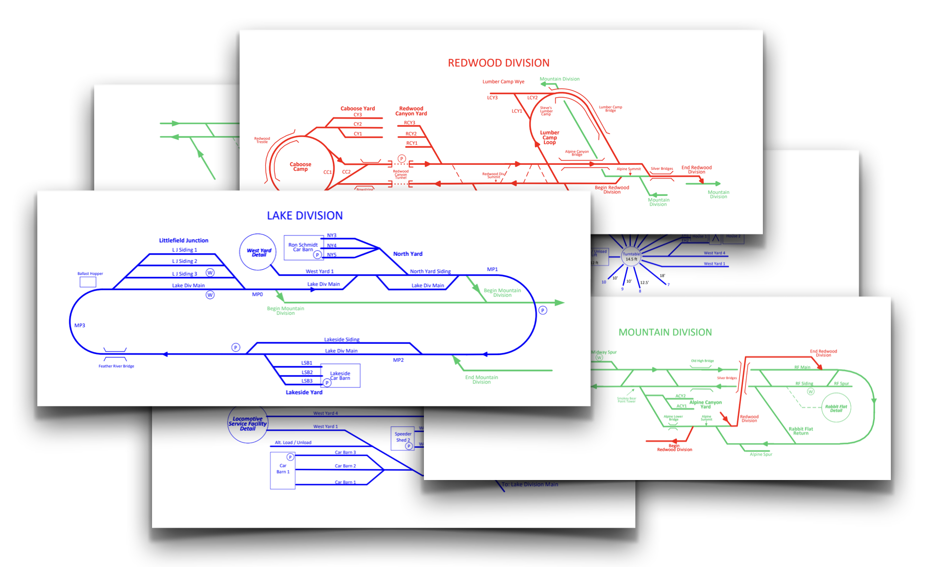
Switch Maps
Members can click the following link to access our Railroad Maintenance & Switch Manual/Maps. A google account/login is required to view. If you do not have access rights click here.
